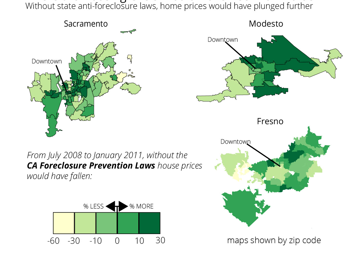
The map was generated in R using the choroplethr package to create county-level details. It was then polished in Adobe Illustrator.
Courtesy of UCLA Anderson Review